Severe Weather Threat Continues: First Alert Issued for Chantal Floods North Carolina Following Widespread Flooding
DURHAM, N.C. — The Carolina Weather News Team has declared Thursday a First Alert Day as another round of severe storms is expected to impact the region. Following days of intense rain and flooding, communities across the Triangle and Piedmont regions are once again preparing for potentially hazardous weather.
Thunderstorms Redeveloping Thursday Afternoon
Forecasters warn that thunderstorms will redevelop Thursday afternoon, moving from the Piedmont into the Triangle by evening. The primary threats include:
- Damaging wind gusts, especially in western counties
- Flash flooding, more widespread due to already saturated ground
- Heavy rainfall, with localized totals adding stress to low-lying
Similar conditions to Wednesday’s storms are expected, but forecasters emphasize that flash flood guidance has decreased significantly after recent downpours, increasing the risk of sudden and severe flooding.
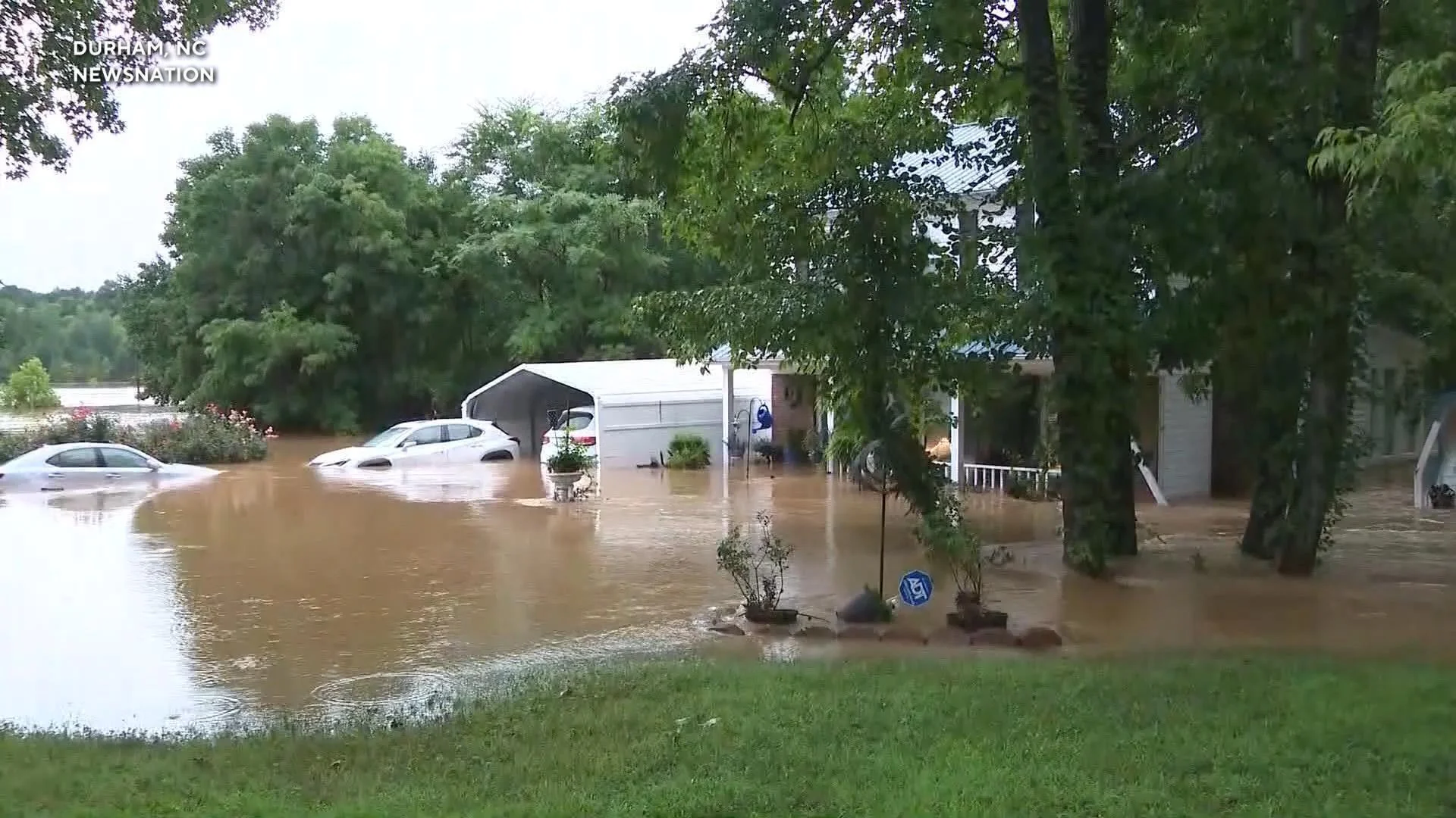
Wednesday’s Impact: Flooding, Downed Trees, and Road Closures
On Wednesday evening, a large tree fell across Interstate 85 near Redwood Road in Durham, completely blocking the roadway. While no injuries were reported, the road remained closed for several hours as crews worked to remove the obstruction.
The Durham Police Department urged residents to avoid flood-prone areas, citing multiple road closures. Many parts of Durham and surrounding counties were already under a Flood Watch through Thursday morning, and some remain at risk.
Areas Still Recovering from Chantal’s Remnants
The situation is further complicated by the lingering effects of Tropical Storm Chantal, whose remnants caused historic flooding across the region earlier in the week. Counties across the state are still drying out and assessing damage from the flooding that occurred from Sunday into Monday.
Notable Flooded Areas Reported:
In Durham:
- Anderson Road at Chapel Hill Road
- Garrett Road at Durham-Chapel Hill Boulevard
- 4200 Block of University Drive (between MLK Jr. Blvd. & Shannon Road)
- N. Duke Street at W. Morgan Street
- Hunt Street and Foster Street
In Granville County (Oxford):
- Goochs Mill Road and Enon Road
- US 158 and Graham Hobgood Road
In Orange County:
- Orange Grove Road and S. Churton Street (Hillsborough)
- Bennett Road and Mt. Carmel Church Road (Carrboro)
- Prichard Avenue, Estes Drive, and Willow Drive (Chapel Hill)
In Siler City:
- Several reports of downed trees, blocking rural roads
More Rain to Come: Forecast Through the Weekend
Meteorologists say the atmosphere over the region remains very humid, and as long as that airmass lingers, storm chances will persist. Thursday night into Friday, residents can expect:
- Isolated to scattered thunderstorms
- Ponding of water on roads
- Localized flash flooding in low-lying areas
Strong storms may bring damaging wind gusts and brief downpours, especially where instability and forcing mechanisms are strongest.
Stay Prepared and Informed
Residents are encouraged to:
- Avoid driving through flooded roads
- Secure outdoor items ahead of strong winds
- Stay updated on the latest weather alerts from Carolina Weather News
- Monitor local emergency services and traffic advisories
With the weekend forecast showing continued storm potential, North Carolinians are urged to remain cautious, especially in areas still struggling to recover from recent severe weather.